Recent photos
-

20 July 2025 -

29 January 2025 -
29 January 2025 -

15 January 2025 -
7 December 2024 -

28 November 2024 -
8 November 2024 -

14 October 2024 -
4 October 2024 -
4 October 2024 -

3 October 2024 -
25 September 2024 -

22 September 2024 -

13 September 2024 -

13 September 2024 -
5 September 2024 -

30 August 2024 -
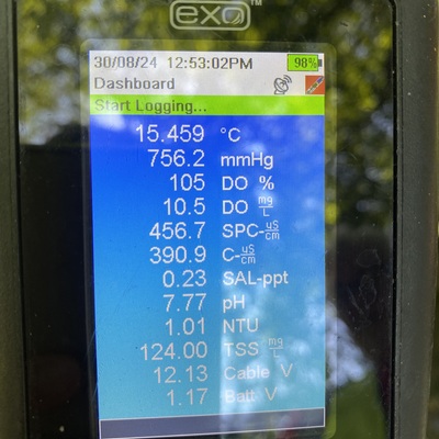
30 August 2024 -

29 July 2024 -
22 July 2024