Location
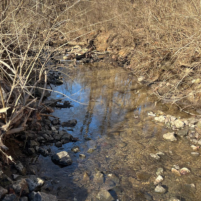
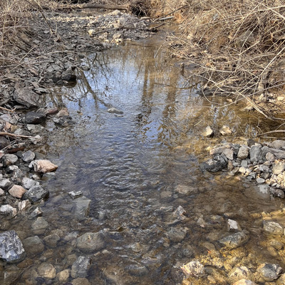
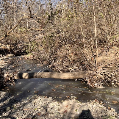
Unnamed Creek on Rock Island Greenway
unnamed creek
unnamed creek in Illinois
Dataset summary
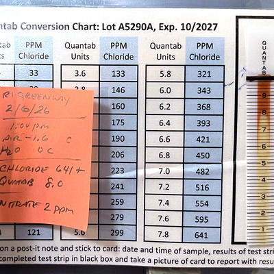
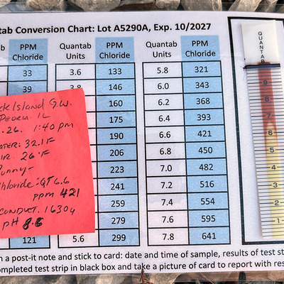
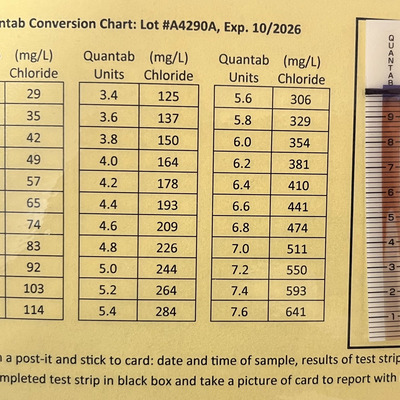
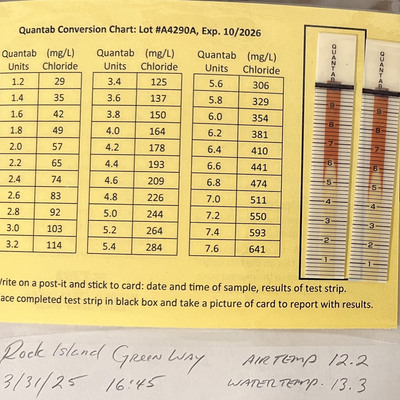
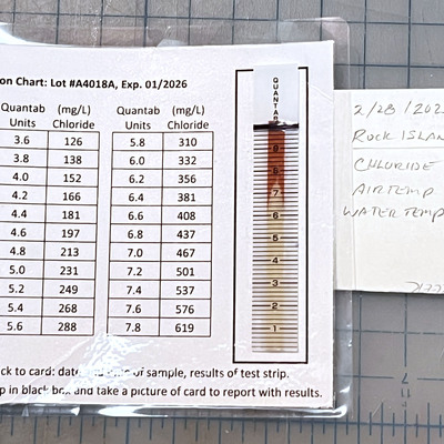
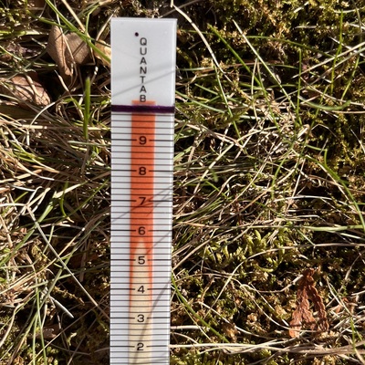
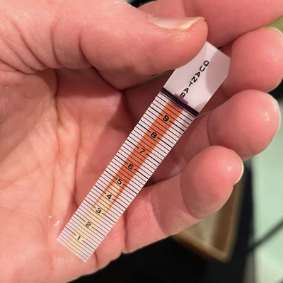
Unnamed Creek on Rock Island Greenway has data for air_temperature, water_temperature, chloride, nitrates, Ice on, current_weather, previous_weather, pollution_sources, colour, previous_weather_description, clarity, water_level, on_the_water_s_surface, water_use, odour, algae, ph, conductivity, and current_weather_description from 24 December 2023 to 7 February 2026.
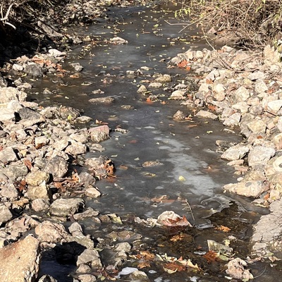
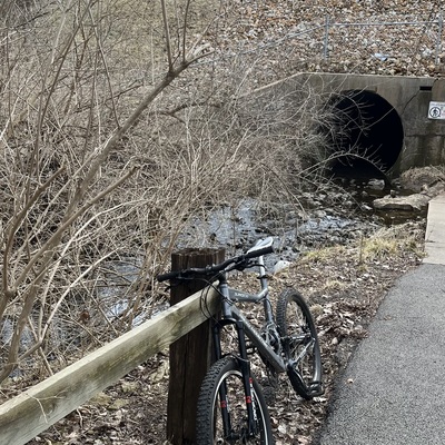

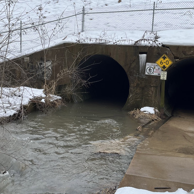


- Water body type River or stream
- Dataset Winter Chloride Watch, National Great Rivers
- Data collector Robert Rowe
- Location description
- stream that passes under under IL route 6 alongside the Rock Island Greenway. Two meters across, shallow, adjacent to paved bike path. Accessed by foot or bicycle; from the west 3/4 miles from Alta Road or from South 1 mile from trail crossing at Pioneer Park drive. This location is down stream for an Industrial Park, an Airport and four-lane highway.