Location
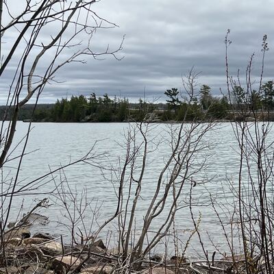
Turtle Rock Preserve
St. Mary’s River
St. Mary’s River in Ontario
Dataset summary
Turtle Rock Preserve has data for hardness, chlorine, previous_weather, current_weather_description, current_weather, water_temperature, air_temperature, conductivity, water_depth, alkalinity, secchi_depth, ph, and previous_weather_description from 28 April 2024 to 29 September 2024.
About this location
- Water body type Channelized stream
- Dataset Central Algoma Water Quality Monitoring, Central Algoma Land Trust
- Data collector Lorie Springall
- Location description Facing South Toward St. Joseph Island Bridge
Data sharing
-
All datasets are open by default.
Download location data
This data is part of a bigger dataset, Central Algoma Water Quality Monitoring.