Location
Tom Berry Rd
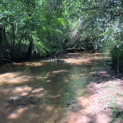
Sellers Creek
Sellers Creek in Mississippi
Dataset summary
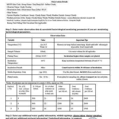
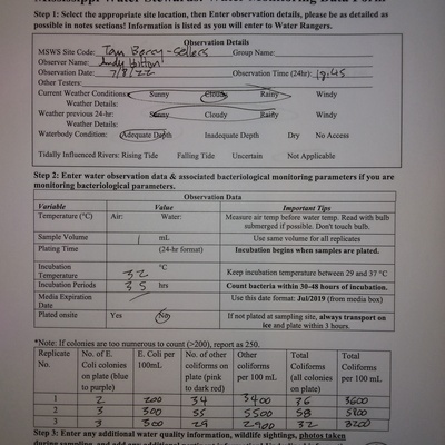
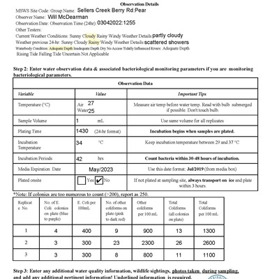
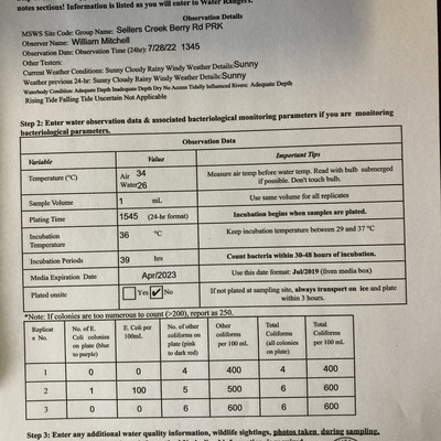
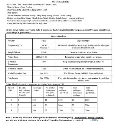
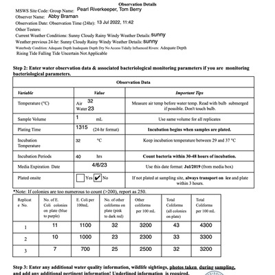
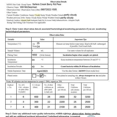
Tom Berry Rd has data for e_coli, incubation_temperature, water_temperature, incubation_time, air_temperature, previous_weather, total_coliform, other_coliform, current_weather, water_depth, previous_weather_description, and current_weather_description from 11 May 2022 to 7 June 2023.

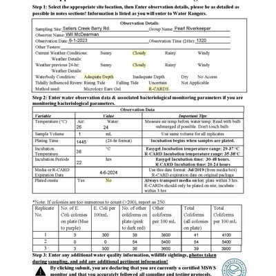


- Water body type River or stream
- Dataset Mississippi Water Stewards, Mississippi State University
- Data collector Abby Braman
Data sharing
-
All datasets are open by default.
Download location data
This data is part of a bigger dataset, Mississippi Water Stewards.
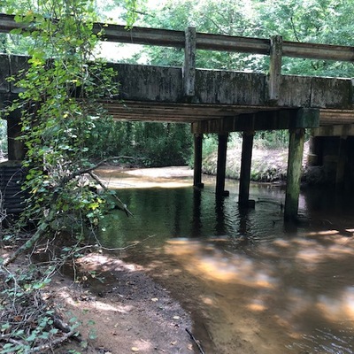
- Location description
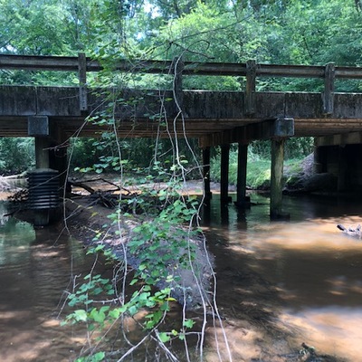
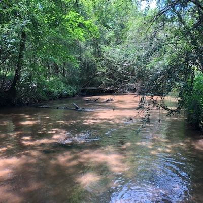
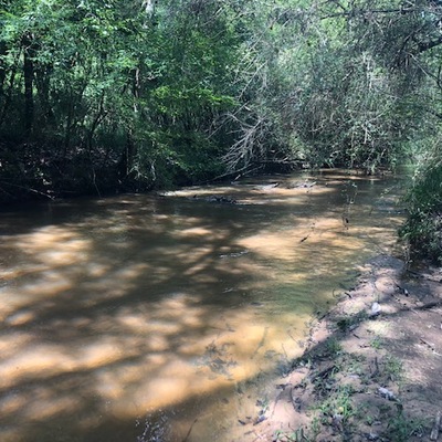
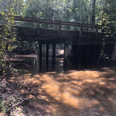
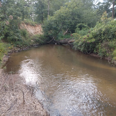
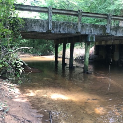
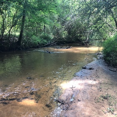
- After turning on Tom Berry Road from East Jackson, cross the bridge and park on the first available narrow road shoulder on the north side. Walk along the road shoulder, cross the bridge, and walk down the north road bank to the test site on the right downstream (northeast) side of bridge. There is a somewhat steep bank that drops to a flat area along creek, although the bank drop is no greater than that at Sellers Creek Hwy 149. If the bank is drop is too great, an alternative site is available on the left upstream (southwest) side of the bridge. The alternative is accessed from the upstream roadbank before cross the bridge from the parking site, then walking down and across and side drainage that enters the creek.