Location
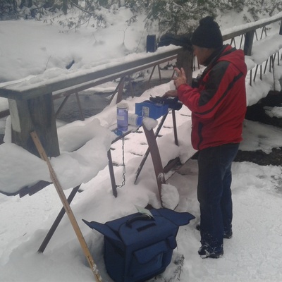
Scout Valley Mill Creek Bridge
Mill Creek
Mill Creek in Ontario
Dataset summary
Scout Valley Mill Creek Bridge has data for turbidity, phosphates, nitrate_nitrogen, previous_weather_description, ph, alkalinity, water_depth, air_temperature, water_temperature, previous_weather, oxygen, and chloride from 24 October 2016 to 26 November 2019.
- Water body type River or stream
- Dataset Community Science Water Monitoring Program, Couchiching Conservancy
- Data collector Couchiching Conservancy
Data sharing
-
All datasets are open by default.
Download location data
This data is part of a bigger dataset, Community Science Water Monitoring Program.
- Location description
- TThis site is located just downstream of the Mill Creek Bridge. Mill Creek is part of the Oro Creek North sub watershed of the Lake Simcoe Watershed. Mill Creek makes its way through Scout Valley, under Hwy 11, through a Provincially Significant Wetland, and then merges with "Ben's Ditch" before flowing into Lake Simcoe beside the City of Orillia Landfill. This location is frequented by off leash dogs. This site has been monitored by trained volunteers since 2016. No data collected in 2021.