Location
Perch Creek at Doyle Road
Perch Creek
Perch Creek in Ontario
Dataset summary
Perch Creek at Doyle Road has data for previous_weather, previous_weather_description, water_temperature, phosphates, turbidity, oxygen, ph, alkalinity, water_depth, nitrate_nitrogen, air_temperature, current_weather, current_weather_description, and chloride from 10 July 2015 to 2 November 2019.
About this location
- Water body type River or stream
- Dataset Community Science Water Monitoring Program, Couchiching Conservancy
- Data collector Couchiching Conservancy
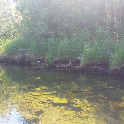
- Location description Wider section of Perch Creek, downstream of Perch Lake and a number of ranches. Testing takes place just downstream of the bridge at Doyle Road. This is a roadside site. The water is tested close to a riffle area in the stream. This site has been tested by trained community scientists since 2015.
Data sharing
-
All datasets are open by default.
Download location data
This data is part of a bigger dataset, Community Science Water Monitoring Program.