Recent photos
-
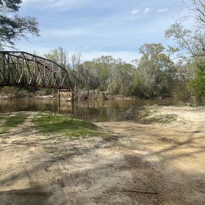
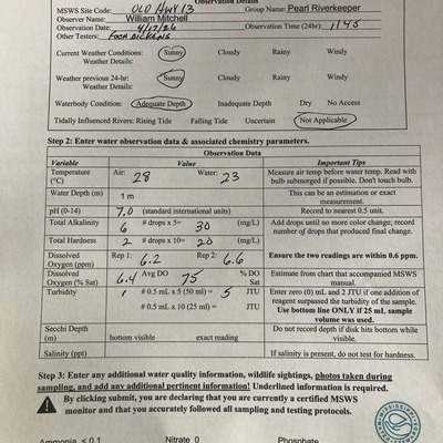
27 March 2025 -
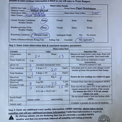
28 February 2025 -

28 February 2025 -
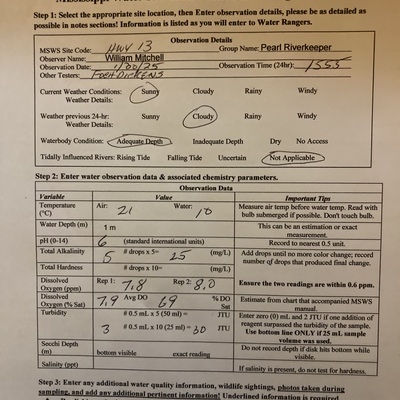
30 January 2025 -
30 January 2025 -
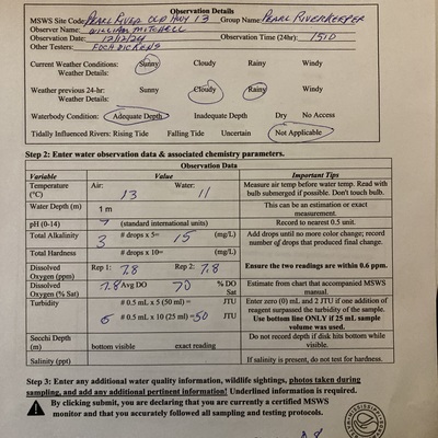
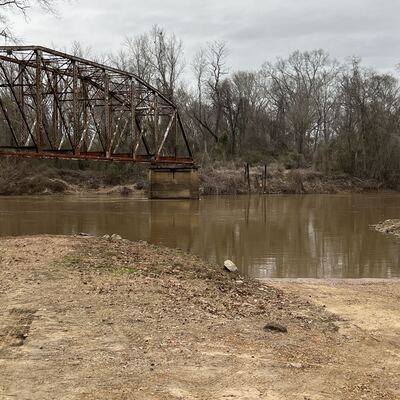
12 December 2024 -

12 December 2024 -
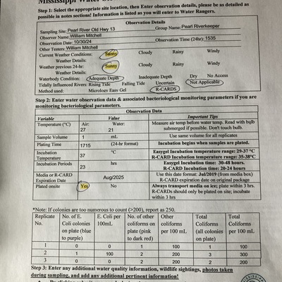
30 October 2024 -
30 October 2024 -
30 October 2024 -
26 September 2024 -
26 September 2024 -
27 August 2024 -

27 March 2024 -

23 August 2024 -

16 August 2024 -
9 August 2024 -

1 August 2024 -
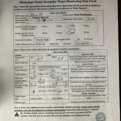
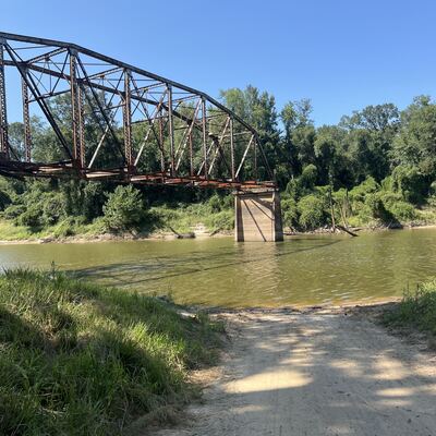
25 July 2024 -

23 July 2024