Recent photos
-
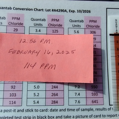
16 February 2025 -
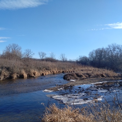
11 February 2025 -
11 February 2025 -
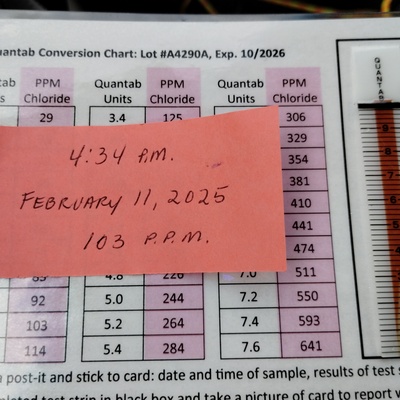
11 February 2025 -
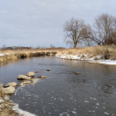
17 January 2025 -

17 January 2025 -
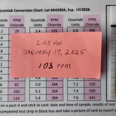
17 January 2025 -

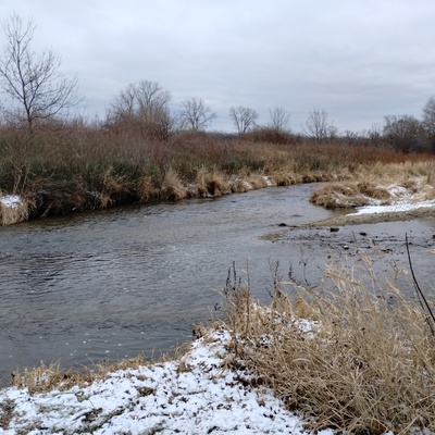
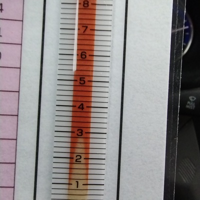
22 December 2024 -
22 December 2024 -

22 December 2024 -
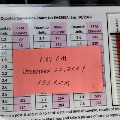
22 December 2024 -

20 December 2024 -

20 December 2024 -

20 December 2024 -
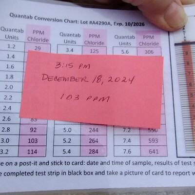
18 December 2024 -
18 December 2024 -
18 December 2024 -
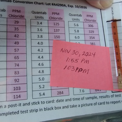
30 November 2024 -
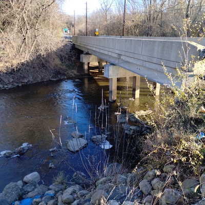
30 November 2024 -
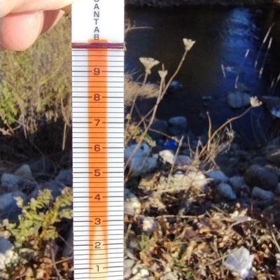
30 November 2024