Location
Foxwood Beck 2 (Outfall 10 metre mixing zone)
Wyke Beck
Wyke Beck in England
Dataset summary
Foxwood Beck 2 (Outfall 10 metre mixing zone) has data for current_weather, previous_weather, colour, clarity, algae, on_the_water_s_surface, pollution_sources, odour, water_flow, water_level, water_temperature, conductivity, chlorine, ph, alkalinity, hardness, nitrate_nitrogen, phosphate_phosphorus, ammonia, phosphates, and air_temperature from 28 March 2026 to 30 May 2026.
About this location
- Water body type River or stream
- Dataset Roundhay Freshwater Watch, Roundhay Environmental Action Project and Friends of Roundhay Park
- Monitoring purpose Investigative
- Data collector Jane Stanbury
- Land use Urban park
- Bank vegetation Trees and shrubs, No vegetation cover
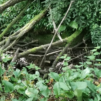
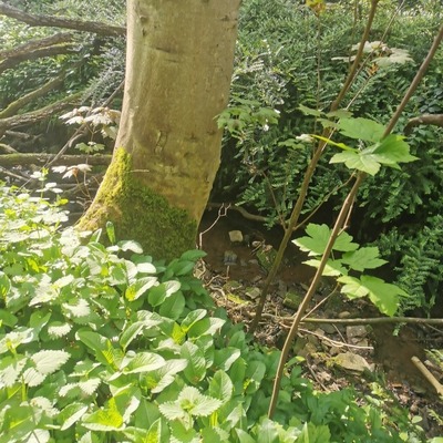
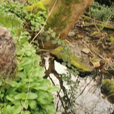
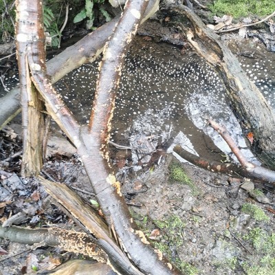
- Location description The site is 10 metres down from the outfall pipe in Foxwood Beck. 3 CSOs feed in, coming under the road and into the Beck. The CSO's are 1. Devonshire Crescent 2. Lidget Park Road. 3. 3. Foxwood (109 No 2 ) The Beck starts from the outfall pipe which is at the bottom of steep banks next to a carpark and bottle bank. Rubbish blows down here and also can be fly tipping. The beck flows into Waterloo Lake, going underground after about 300 metres and flowing into the lake by the Lakeside cafe and our testing site Waterloo Lake Cafe.
Data sharing
-
All datasets are open by default.
Download location data
This data is part of a bigger dataset, Roundhay Freshwater Watch.