Recent photos
-

19 April 2025 -
19 April 2025 -

19 April 2025 -

28 March 2025 -
28 March 2025 -
27 February 2025 -

27 February 2025 -

27 February 2025 -

27 February 2025 -

25 January 2025 -

25 January 2025 -

25 January 2025 -
25 January 2025 -

21 December 2024 -
21 December 2024 -
21 December 2024 -
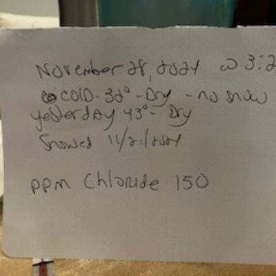
29 November 2024 -

29 November 2024 -
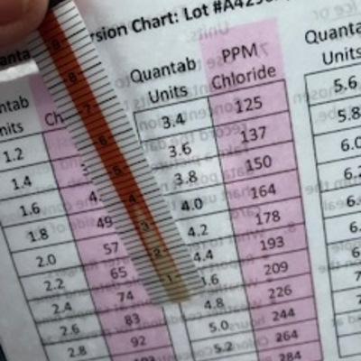
29 November 2024