Location
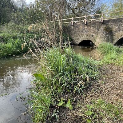
Downstream of the westerly arch of Lower Eashing bridge
River Wey
River Wey in Surrey
Dataset summary
Downstream of the westerly arch of Lower Eashing bridge has data for previous_weather, previous_weather_description, current_weather_description, current_weather, phosphate_phosphorus, water_temperature, air_temperature, conductivity, alkalinity, nitrate_nitrogen, hardness, chlorine, e_coli, ph, water_flow, on_the_water_s_surface, colour, water_level, clarity, odour, algae, pollution_sources, and water_use from 25 July 2022 to 25 April 2025.

- Water body type River or stream
- Dataset Godalming Hub, River Wey Trust
- Data collector Angus Sim
- Location description
- Small section of the river splits just up stream of the pub at Lower Eashing. It then rejoins the main channel below Lower Eashing bridge. The sample site is just below the westerly arch of the bridge upstream from where the small side channel rejoins the main channel. Right by the small car park. Runoff from the A3 drains into this channel a hundred yards or so upstream from this spot.