This dataset is inactive (last observation on 28 March 2021).
Dataset
Salt Spring Island FreshWater Catalogue (SSIFWC) Project
Dataset summary
Observations
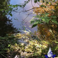
LLCK Larlow creek outfall aka Grants Corner creek
3 parameters tested ▾
conductivity, ph, water temperature
LLCK Larlow creek outfall aka Grants Corner creek
3 parameters tested ▾
conductivity, ph, water temperature
3 parameters tested ▾
conductivity, ph, water temperature
3 parameters tested ▾
conductivity, ph, water temperature
3 parameters tested ▾
conductivity, ph, water temperature
3 parameters tested ▾
conductivity, ph, water temperature
3 parameters tested ▾
conductivity, ph, water temperature
LLCK Larlow creek outfall aka Grants Corner creek
3 parameters tested ▾
conductivity, ph, water temperature
SLCK Soule Creek aka Fulford creek spur
3 parameters tested ▾
conductivity, ph, water temperature
SLCK Soule creek aka Fulford creek spur
3 parameters tested ▾
conductivity, ph, water temperature
XWQW site 2W WelcomePole creek culvert
3 parameters tested ▾
conductivity, ph, water temperature
3 parameters tested ▾
conductivity, ph, water temperature
3 parameters tested ▾
conductivity, ph, water temperature
SLCK Soule Creek aka Fulford creek spur
3 parameters tested ▾
conductivity, ph, water temperature
FNCK FernCreek culvert outfall
3 parameters tested ▾
conductivity, ph, water temperature
LLCK Larlow creek outfall aka Grants Corner creek
3 parameters tested ▾
conductivity, ph, water temperature
3 parameters tested ▾
conductivity, ph, water temperature
FNCK Ferncreek culvert outfall
3 parameters tested ▾
conductivity, ph, water temperature