This dataset is inactive (last observation on 28 March 2021).
Dataset
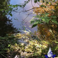
Salt Spring Island FreshWater Catalogue (SSIFWC) Project
Dataset summary
Observations
4 parameters tested ▾
air temperature, conductivity, ph, water temperature
WKBK WB 2 W main Walkers Creek
4 parameters tested ▾
air temperature, conductivity, ph, water temperature
SHCK Sharpe Creek below bridge 221 Booth
4 parameters tested ▾
air temperature, conductivity, ph, water temperature
SHCK Turpel Creek 5m above Sharpe Creek 221 Booth
4 parameters tested ▾
air temperature, conductivity, ph, water temperature
4 parameters tested ▾
air temperature, conductivity, ph, water temperature
WSCK Weston Lake Creek inflow E1
4 parameters tested ▾
air temperature, conductivity, ph, water temperature
4 parameters tested ▾
air temperature, conductivity, ph, water temperature
RUAL Lumley Creek culvert nr 1171 Isabella Pt Rd
4 parameters tested ▾
air temperature, conductivity, ph, water temperature
4 parameters tested ▾
air temperature, conductivity, ph, water temperature
SLCK Soule Creek aka Fulford creek spur
3 parameters tested ▾
conductivity, ph, water temperature
FNCK FernCreek culvert outfall
3 parameters tested ▾
conductivity, ph, water temperature
2112 S Canyon Ck at base of Ribbon Falls
4 parameters tested ▾
air temperature, conductivity, ph, water temperature
LLCK Larlow creek outfall aka Grants Corner creek
3 parameters tested ▾
conductivity, ph, water temperature
4 parameters tested ▾
air temperature, conductivity, ph, water temperature