Location
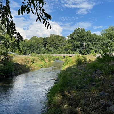
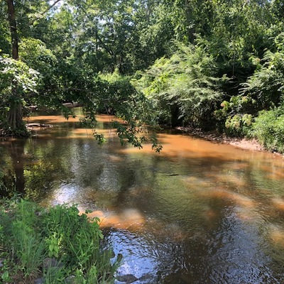
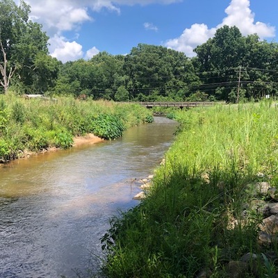
S Main St. Bridge
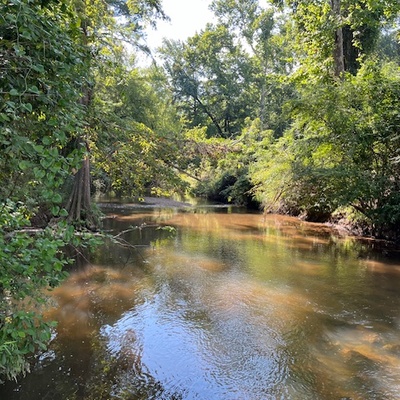
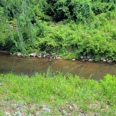
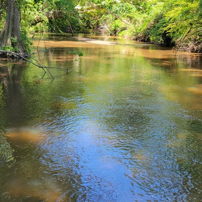
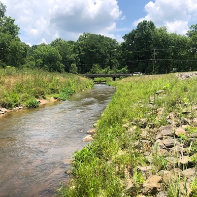
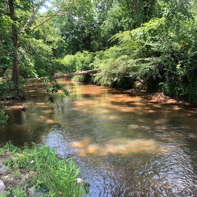
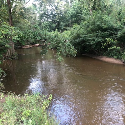
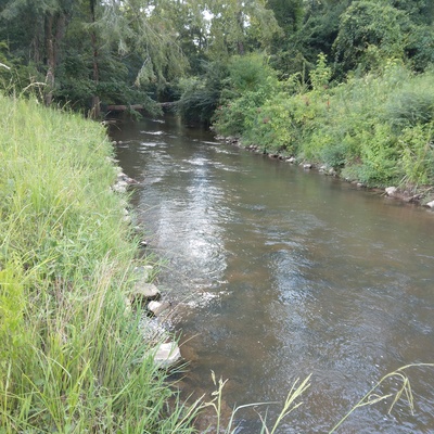
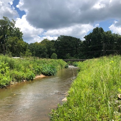
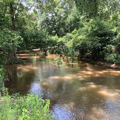
Sellers Creek
Sellers Creek in Mississippi
Dataset summary
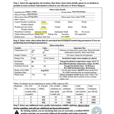
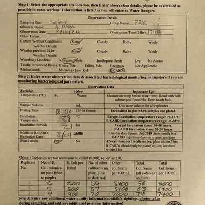
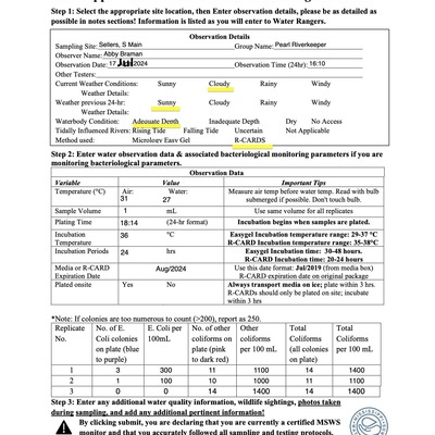
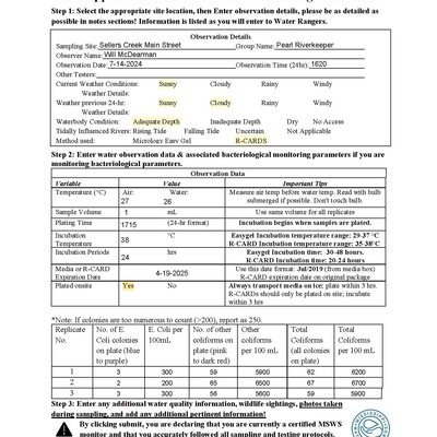
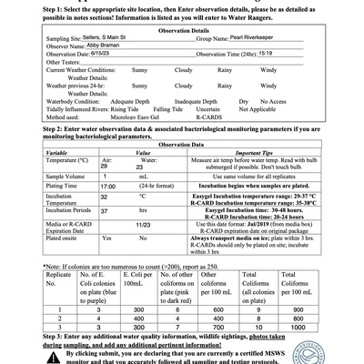
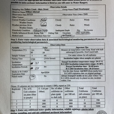
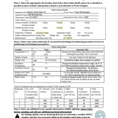
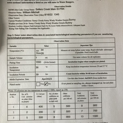
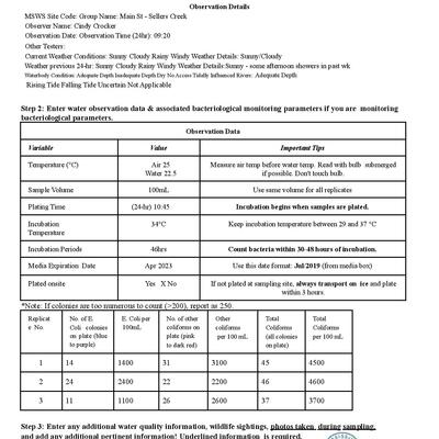
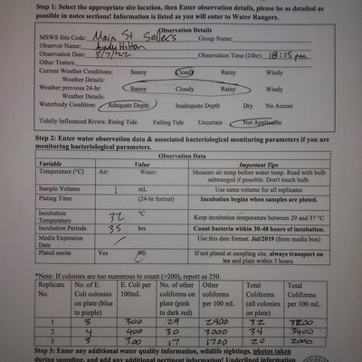
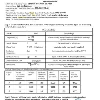
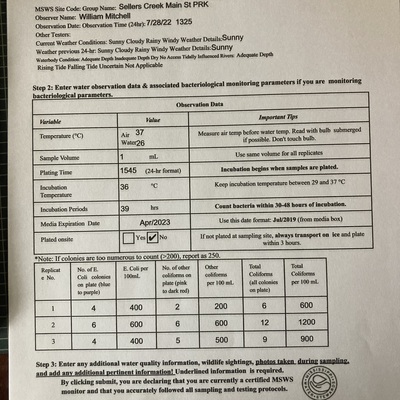
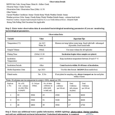
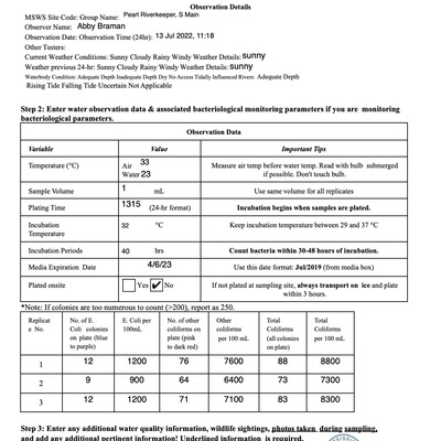
S Main St. Bridge has data for e_coli, previous_weather, current_weather, incubation_temperature, water_temperature, incubation_time, air_temperature, total_coliform, other_coliform, current_weather_description, water_depth, and previous_weather_description from 21 July 2020 to 22 August 2024.


About this location
- Water body type River or stream
- Dataset Mississippi Water Stewards, Mississippi State University
- Data collector Karen Felder
- Location description Sellers Creek is a left-bank tributary of the Strong River in the Middle Pearl River watershed. The creek flows east to west along the southern edge of Mendenhall, MS. It empties into the Strong River at a point just above D'Lo Water Park. The western border of Simpson County is formed by the Pearl River.
Data sharing
-
All datasets are open by default.
Download location data
This data is part of a bigger dataset, Mississippi Water Stewards.