Recent photos
-
3 August 2022 -
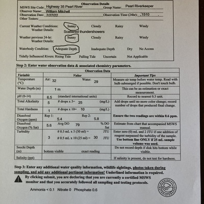
27 July 2022 -
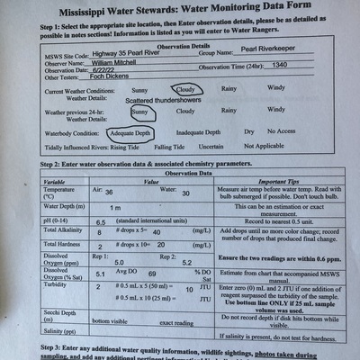
22 June 2022 -
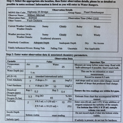
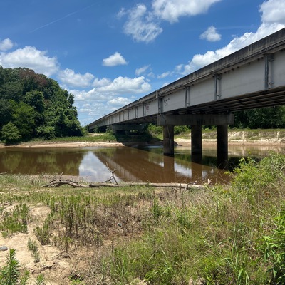
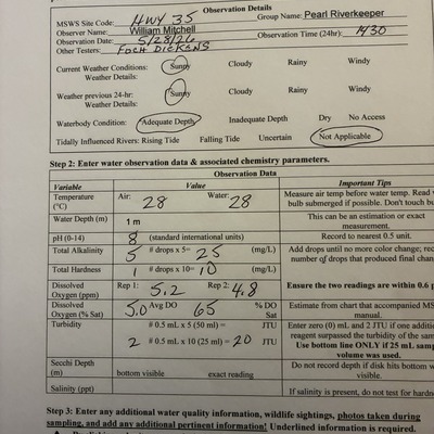
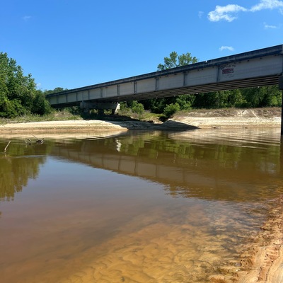
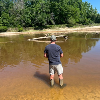
24 May 2022 -
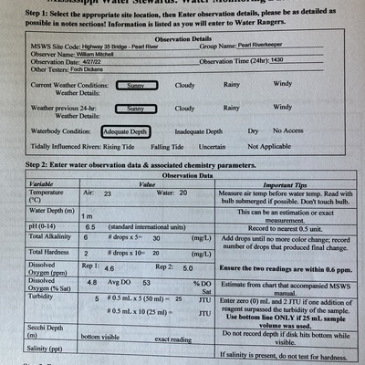
27 April 2022 -
29 March 2022 -
29 March 2022 -
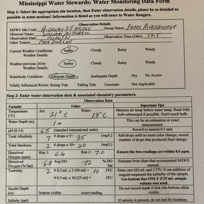
24 February 2022 -
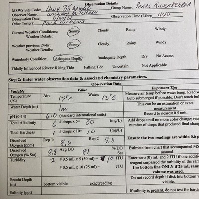
27 January 2022 -
22 December 2021 -
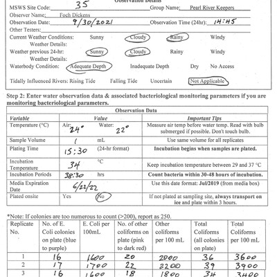
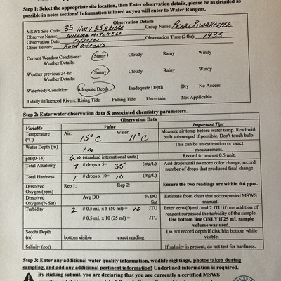
30 September 2021 -
30 November 2021 -
26 October 2021 -
26 August 2021 -
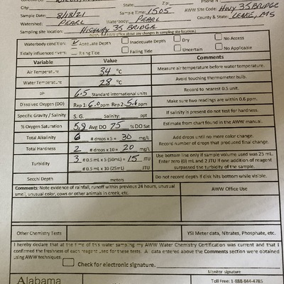
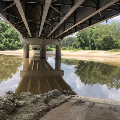
18 August 2021 -
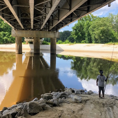
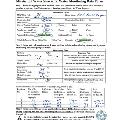
28 July 2021 -
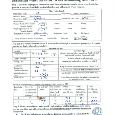
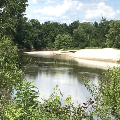
14 July 2021 -
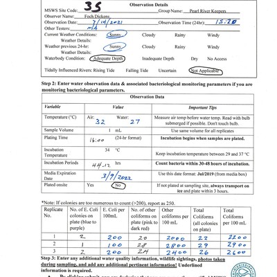
14 July 2021 -
8 July 2021 -
27 May 2021