Observations
7 parameters tested ▾
nitrate-nitrogen, nitrites, oxygen, ph, phosphate, secchi depth (clarity), water temperature
8 parameters tested ▾
air temperature, nitrate-nitrogen, nitrate, nitrites, oxygen, ph, secchi depth (clarity), water temperature
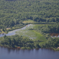
Lac Rocher Fendu at OWL Rafting Resort
7 parameters tested ▾
air temperature, nitrate-nitrogen, nitrites, oxygen, ph, secchi depth (clarity), water temperature
7 parameters tested ▾
air temperature, nitrate-nitrogen, nitrites, oxygen, ph, secchi depth (clarity), water temperature
7 parameters tested ▾
air temperature, nitrate-nitrogen, nitrites, oxygen, ph, secchi depth (clarity), water temperature
7 parameters tested ▾
air temperature, nitrate-nitrogen, nitrites, oxygen, ph, secchi depth (clarity), water temperature
7 parameters tested ▾
nitrate-nitrogen, nitrites, oxygen, ph, phosphate, secchi depth (clarity), water temperature
7 parameters tested ▾
nitrate-nitrogen, nitrites, oxygen, ph, phosphate, secchi depth (clarity), water temperature
7 parameters tested ▾
nitrate-nitrogen, nitrites, oxygen, ph, phosphate, secchi depth (clarity), water temperature
7 parameters tested ▾
nitrate-nitrogen, nitrites, oxygen, ph, phosphate, secchi depth (clarity), water temperature
7 parameters tested ▾
air temperature, nitrate-nitrogen, nitrites, oxygen, ph, secchi depth (clarity), water temperature
7 parameters tested ▾
air temperature, nitrate-nitrogen, nitrites, oxygen, ph, secchi depth (clarity), water temperature
7 parameters tested ▾
nitrate-nitrogen, nitrites, oxygen, ph, phosphate, secchi depth (clarity), water temperature
Downstream of Lighthouse Island
7 parameters tested ▾
air temperature, nitrate-nitrogen, nitrites, oxygen, ph, secchi depth (clarity), water temperature
7 parameters tested ▾
nitrate-nitrogen, nitrites, oxygen, ph, phosphate, secchi depth (clarity), water temperature
7 parameters tested ▾
air temperature, nitrate-nitrogen, nitrites, oxygen, ph, secchi depth (clarity), water temperature
7 parameters tested ▾
nitrate-nitrogen, nitrites, oxygen, ph, phosphate, secchi depth (clarity), water temperature
7 parameters tested ▾
air temperature, nitrate-nitrogen, nitrites, oxygen, ph, secchi depth (clarity), water temperature