This dataset is inactive (last observation on 12 September 2023).
Dataset
Great Lakes Community Monitoring Program- Toronto Hub
Dataset by Swim Drink Fish Canada
Dataset summary
About this dataset
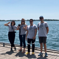
Toronto, like many cities across Canada, has a combined sewer system. Combined sewers are designed to collect stormwater runoff and wastewater in the same pipe. All that combined water usually flows to a wastewater plant for treatment. Untreated sewage spills into the lake from combined sewer overflows (CSOs). They are the largest source of water pollution in Toronto. The usual culprit is rain. Whenever it rains in Toronto, sewage flows into Lake Ontario. Every time. In 2015 alone, CSOs spilled 3.7-million cubic metres of raw sewage into Toronto waters. The Toronto hub was the first and is now one of five monitoring hubs created by Swim Drink Fish. 2021 is the sixth year of sampling at the Inner Harbour sites. Staff along with a group of trained citizen scientists sample the water every Tuesday and Thursday. We sample four main locations in the Inner Harbour: Marina 4, Rees St. Slip, Ontario Place West Island Beach and Bathurst Quay. Each of these locations has a CSO pipe flowing into it. In 2018 two teams of dedicated, trained citizen scientists started monitoring Humber Bay West Park in Etobicoke, and Algonquin Bridge and Snake Island on Wards Island. In 2020, First Street Beach was added as a sampling site. Beginning in 2018, this project has been undertaken with financial support of the Government of Canada through the federal Department of Environment and Climate Change.
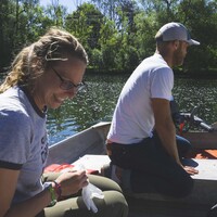
We test primarily for the presence of E. coli. with the use of the IDEXX system. We also take water temperature, and depth of clarity. At specific sampling sites we also measure dissolved oxygen, and pH, Alkalinity, Hardness, and Chlorine, as well as conductivity.
Monitoring program details
- Water quality criteria
- Canada
Data sharing
- All datasets are open by default. Download dataset
- This dataset is shared with DataStream